
After years of working worldwide as a geophysical research technician with the Dublin Institute for Advanced Studies in Dublin, Ireland, I have recently returned to Canada to work as a self-employed contractor. My specialty is a method called magnetotellurics or MT. MT is a method that provides information on the electrical conductivity of the Earth by measuring the natural time-varying electric and magnetic fields at its surface. These fields are generated from electrical currents that are produced from natural variations in the Earth's magnetic field. One of the things that I really enjoy about my work is the many different applications that exist for MT and that new applications are still being developed. The MT method is commonly used in the deep exploration of the Earth, helping to understand tectonic processes and structure at depths to 100s of kilometers. It is also used in shallow surveys such as mineral exploration and, it recent years, hydrocarbon exploration. After completing a bachelors degree in geology at Carleton University in Ottawa, and a masters degree in geophysics at Syracuse University in New York, I have been working as a geophysicist, applying the MT method on four different continents. My work allows me to travel and experience new cultures while learning about and comparing the geology worldwide.
 Q: What is the title of your job and what do you do?
A: I am a self employed geophysical contractor specializing in magnetotellurics.
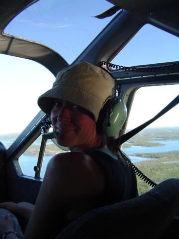
A: Funded by Geoscience B.C., the majority if my time is currently spent on a project in the Nechako Basin of British Columbia designed to characterize the conductivity structure of the basin sediments and to analyze the usefulness of the method as a tool in hydrocarbon exploration. After collecting the data in the fall of 2007, the data are being analyzed, modelled and interpreted at the Geological Survey of Canada, in Ottawa. Results are presented at various conferences across Canada with the hope of better understanding the potential for oil and gas within the Nechako region. In addition to this work, I occasionally take part in smaller MT projects that take me to far off regions of Canada, including the ice roads north of Inuvik, camping on Baffin Island and helicopter trips out of Coral Harbour on Southampton Island.
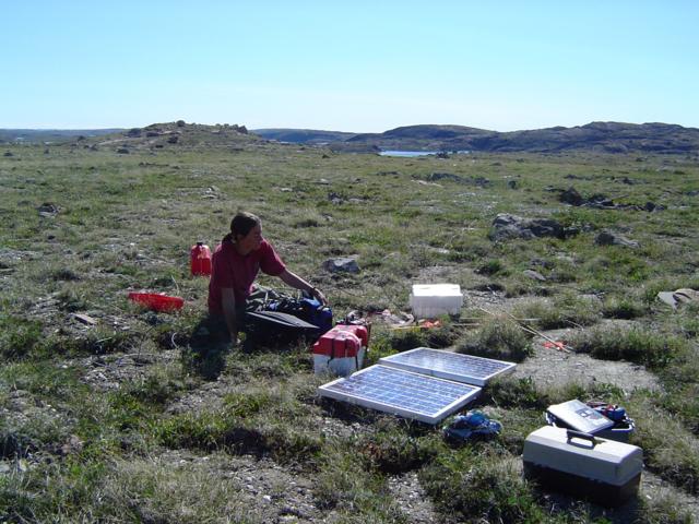
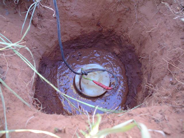
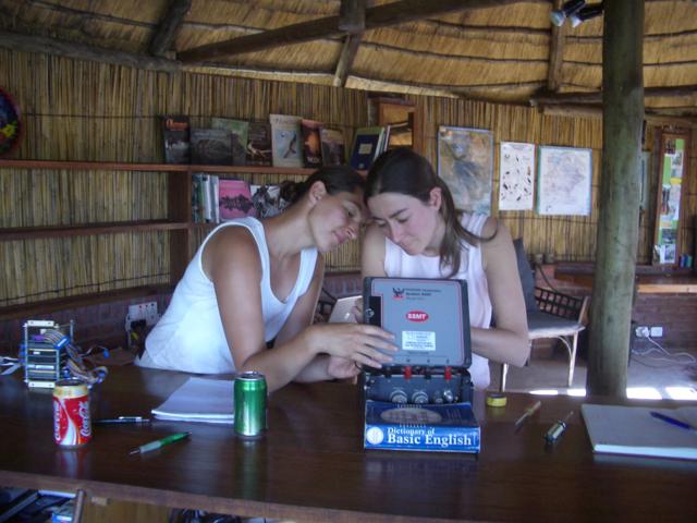
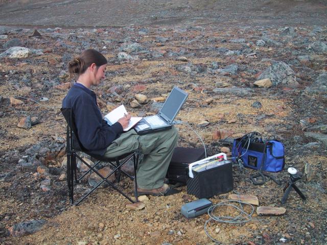
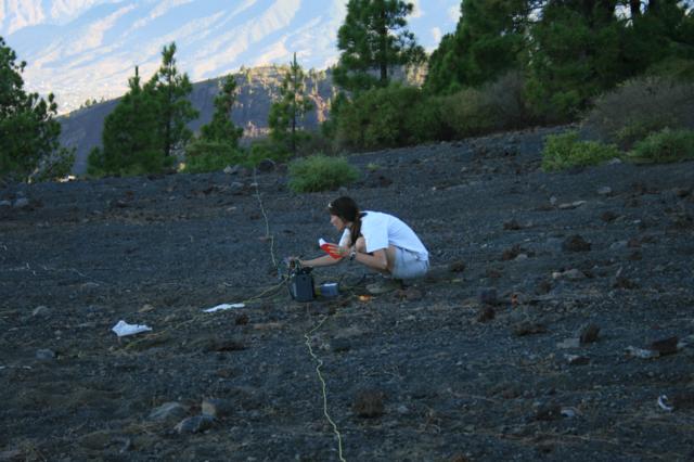
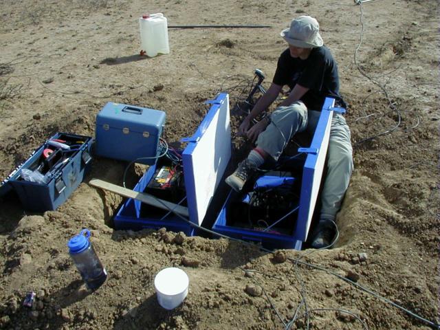
A: There are two components to this type of work, the first involves data collection in the field. During this time the work hours are typically long up to 12 hours a day, working outside installing the instruments to record data and inside processing the data and planning the field logistics. The second component involves data analysis, modelling and interpretation. This usually takes place in regular 9am – 5pm office hours.
A: I spend most of my time either at the office or working from home. Occasionally I work at the lab testing and packing the equipment and I spend a couple of months a year working in the field.
A: We use different data recording instruments that measure different frequencies, depending on the target depth of interest. The instruments consist of electrodes to measure the electric field, magnetometers to measure the magnetic field and a recording unit.

A:An undergraduate degree in Earth Sciences, as well as a graduate level degree in geophysics is required for the work.
A: I recommend someone who enjoys working outdoors. Someone who is capable of working well with others as the field work often requires many people in close living situations such as camping, but also someone capable of working independently in an office setting.
A: The salary range is $55,000 to $70,000 CAD.
A: What I enjoy most about the job is the combination of working outdoors while traveling to isolated or exotic places, while also spending time working regular office hours in the city.
 Q: What are the advantages?
A: There is lots of opportunity for travel, whether it be to remote locations in northern Canada or worldwide destinations. Many of the projects involve several different organizations or different disciplines. This means that there is always a chance to work with new people and to integrate results with other scientific methods.
A: There are many different paths that can be taken as a geophysicist. Working in academics teaching at a university, doing research to advance the methodology, or working for industry looking for gas, oil, or mineral resources.
A: The field work can be quite physically demanding. It involves digging the instruments into the ground and depending on the project, may involve hiking into remote site locations.

A: I have always been interested in sciences, but could not see myself working in a laboratory environment. I was offered a job working on a project in northern Ontario with the Geological Survey of Canada after my undergraduate degree. I enjoyed the work and learned a lot about the method, enough to decide to continue and get a master's degree in this field.
A: I have many very memorable experiences, it is difficult to pick one. Some are very exciting – using a float plane, helicopter, boat or snowmobile to deploy sites, crossing rivers or hiking volcanoes to pick them up. But my favorite times are usually in the evenings. I can remember sitting outside my safari tent to process the first few sites of the survey after a long day of driving and digging under the hot African sun. We were waiting to see if all our hard work was going to give us good results while listening to the sounds of hundreds of birds and watching the most incredible sunset imaginable.
The learning process does not end when you finish school. The Earth sciences, and geophysics are disciplines that are constantly evolving and we all need to continue learning in order to get the best results for every project.


